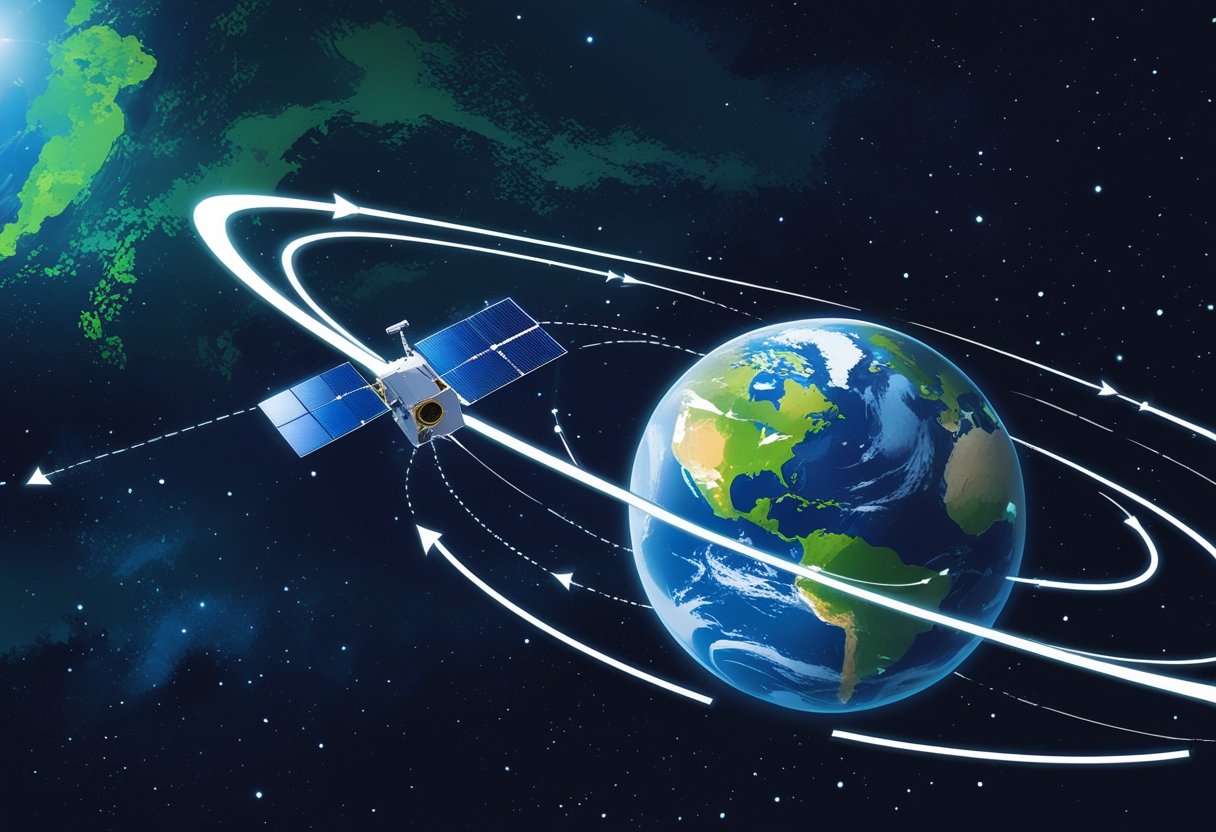
You watch a tiny dot streak across the sky and wonder how it keeps circling without falling. Satellites stay aloft because their forward speed continuously bends their path around Earth, so gravity pulls them inward while their motion keeps them from hitting the ground.
You’ll explore how gravity and motion work together, why different altitudes need different speeds, and how tiny forces like atmospheric drag or collisions can change an orbit. Expect clear examples, practical explanations of orbital types, and recent innovations that keep satellites doing useful work above your head.
Why Satellites Don’t Fall Out of Orbit

Satellites stay aloft because of a precise balance between gravity pulling them inward and their sideways speed carrying them around Earth. This balance creates a continuous curved path that keeps objects like the International Space Station circling instead of plummeting.
The Myth of Floating and Falling
You might picture satellites as hovering or being held up by something, but that’s not accurate. Satellites are constantly pulled toward Earth by gravity; they do not float. What makes them appear stationary is their horizontal velocity: at orbital speed they travel fast enough that as they fall, Earth’s surface curves away beneath them.
Low Earth orbit satellites, including the International Space Station, experience a small amount of atmospheric drag that slowly lowers their altitude. Operators periodically fire thrusters to raise altitude and correct drift. For a clear explanation of how initial speed and altitude set an orbit, read this NOAA explanation of why satellites don’t fall out of the sky (https://www.nesdis.noaa.gov/news/why-dont-satellites-fall-out-of-the-sky).
Continuous Free-Fall Explained
Think of orbit as perpetual free-fall. You throw a ball forward and it falls to the ground; a satellite moves so fast horizontally that its fall matches Earth’s curvature. The result: the satellite keeps missing Earth. This applies to satellites at different altitudes: lower satellites need greater speed to balance the stronger gravitational pull.
The International Space Station orbits roughly 400 km above Earth and travels near 7.7 km/s. Without occasional boosts to counteract atmospheric drag, the ISS would reenter within about a year. Satellites beyond low Earth orbit, like geostationary craft, sit much farther out and need far less correction because atmospheric drag is negligible.
Newton’s Cannonball Thought Experiment
Newton imagined firing a cannonball from a mountain at increasing speeds. At low speed it lands close; at higher speed it travels farther before hitting; at orbital speed it circles Earth continuously. This thought experiment captures the core physics: gravity provides the centripetal force while horizontal velocity provides the inertia that prevents radial collapse.
You can apply the same logic to real satellites. Mission planners choose launch velocity and altitude so gravitational acceleration (g) and orbital velocity satisfy v = sqrt(GM/r). That equation tells you the speed needed at radius r to maintain orbit. For more on how gravity and speed set orbit lifetimes and design, see JAXA’s overview of orbital decay and drag (https://www.satnavi.jaxa.jp/en/satellite-knowledge/trivia/centrifugal-force/index.html).
The Forces at Play: Gravity and Motion
You’ll see how Earth’s gravity pulls inward while your satellite’s motion tries to carry it straight ahead, and how those competing effects produce a steady curved path around the planet.
Gravitational Force and Earth’s Pull
Earth’s gravity acts on every part of your satellite, pulling it toward Earth’s center with a force proportional to the satellite’s mass and inversely proportional to the square of its distance from Earth. This gravitational force provides the inward acceleration that prevents your satellite from flying off in a straight line.
Closer to Earth, gravity is stronger; a low Earth orbit (LEO) satellite at ~400 km sees noticeably higher gravitational pull than one at geostationary altitude (~35,786 km). That stronger pull requires more attention during launch and re-entry planning.
Key points:
- Gravity = G·(M_earth·m_sat)/r^2.
- Stronger pull at lower r increases required centripetal acceleration.
- Gravity continuously redirects your satellite’s straight-line inertia into a curved path.
Centripetal and Centrifugal Forces
When you watch a satellite in orbit, gravity acts as the centripetal force — it pulls the satellite inward so the path curves around Earth. Centripetal force is a real, inward-directed force needed for circular motion; gravity supplies that role.
“Centrifugal force” can appear in a rotating reference frame you occupy with the satellite; it’s an apparent outward force you use when analyzing motion from the satellite’s rotating perspective. Treat centrifugal force as a useful bookkeeping term in that non-inertial frame, not an extra physical push from space.
Practical distinctions:
- Centripetal (real): gravity providing inward acceleration, a = v^2/r.
- Centrifugal (apparent): used in rotating frames to balance equations, points outward.
- Collisions and orbital changes alter required centripetal force and change trajectories.
The Role of Orbital Velocity
Orbital velocity sets how fast your satellite moves tangentially so gravity bends its path into an orbit instead of pulling it down to Earth. For a circular orbit, v = sqrt(G·M_earth/r). Increase altitude (r), and the required orbital velocity decreases; at geostationary altitude the orbital speed is lower than in LEO.
If your satellite’s velocity is too low, atmospheric drag and gravity will cause orbital decay and re-entry. If it’s too high for a given altitude, the path becomes elliptical or the satellite may move to a higher orbit. Small velocity adjustments using onboard propulsion change orbit shape, inclination, or station-keeping.
Operational notes:
- LEO typical speeds ~7.7 km/s at 400 km altitude.
- Geostationary speed lower, timed to match Earth’s rotation.
- Propulsion is for orbital changes and collision avoidance, not for “staying up.”
Types of Orbits and Their Purposes
You’ll learn how altitude, speed, and orbital period shape a satellite’s role, from rapid Earth imaging to continuous global communications. Each orbit trades coverage, latency, and lifetime in ways that determine which missions succeed.
Low Earth Orbit (LEO) Basics
LEO ranges roughly from 160 km to 2,000 km above Earth. You find the International Space Station and many Earth observation satellites here because proximity gives high-resolution imaging and low communication delay.
Satellites in LEO travel very fast — about 7.8 km/s at 400 km altitude — so they complete an orbit in about 90–100 minutes. That speed provides frequent revisits for weather, remote sensing, and reconnaissance but creates short ground contact time for any single pass.
LEO suits constellations that need low latency and many satellites, such as Starlink and other broadband systems. The downside for you: atmospheric drag slowly lowers altitude, requiring occasional boosts or eventual reentry. Collision risk increases as crowding grows, so operators perform collision avoidance maneuvers.
Medium Earth Orbit (MEO) Explained
MEO spans roughly 2,000 km to 35,786 km and hosts navigation constellations because it balances coverage and signal strength. You’ll find GPS and Galileo satellites around 20,000 km where each satellite covers much larger ground areas than LEO.
Orbital periods in MEO often sit between 4 and 12 hours, so satellites repeat ground tracks less frequently than LEO but more predictably than GEO. That predictability helps global positioning systems deliver consistent timing and location fixes to your devices.
MEO satellites need more onboard fuel for station-keeping than LEO but far less than GEO. Their moderate distance reduces launch cost compared with GEO while offering long operational lifetimes, which suits systems designed for continuous, global services like navigation and some communications.
Geostationary Orbit (GEO) and Synchronization
GEO sits at 35,786 km above the equator where an orbital period matches Earth’s rotation. From your perspective on the ground, a geostationary satellite appears fixed in the sky, making it ideal for television, long-range communication, and continuous weather observation.
Because a single GEO satellite covers about one-third of Earth’s surface, operators place networks of three or more to achieve near-global geostationary coverage. The fixed position simplifies ground antenna pointing and supports constant links for broadcast and meteorological satellites.
GEO satellites require powerful launch vehicles and significant station-keeping fuel due to gravitational perturbations. You trade higher latency and larger propagation delay for continuous coverage, which is why GEO complements LEO and MEO rather than replacing them.
Specialty Orbits and Unique Missions
Specialty orbits tailor geometry or timing to mission needs: sun-synchronous orbits give consistent local solar time for your imagery, Molniya or highly elliptical orbits prolong coverage over high latitudes, and Lagrange points host deep-space or constant-Sun views like DSCOVR.
Sun-synchronous orbits (a polar LEO variant) let Earth observation and weather satellites capture images at the same local solar time each pass, improving lighting consistency for analysis. Molniya orbits provide long dwell times over polar regions where GEO coverage is poor, so you get extended communications for high latitudes.
You’ll also see mission-specific uses like formation flying for interferometry, graveyard orbits for end-of-life GEO satellites, and orbit-raising transfers between these regimes. Understanding these choices explains why your GPS, weather, and communication services use different orbital families to deliver the capabilities you depend on.
The Balance: Speed, Altitude, and Orbital Mechanics
You’ll see how orbital velocity, altitude, and basic orbital mechanics combine to keep a satellite circling Earth. The sections below explain the specific speeds and effects you’ll need to understand to predict or change an orbit.
The Perfect Speed for Every Altitude
For a circular orbit, you must match orbital velocity to altitude so gravity and inertia balance. Near low Earth orbit (LEO), typical orbital velocity is about 28,000 km/h (roughly 7.8 km/s). At that speed, a satellite’s straight-line motion curves around Earth at the same rate gravity pulls it inward, producing a stable circle.
Higher altitude means weaker gravity, so orbital velocity falls. For example, geostationary orbit at ~35,786 km requires about 11,000 km/h, far below LEO speed. When designing orbits, engineers calculate exact velocity from the altitude and Earth’s mass using orbital mechanics formulas so you get the precise speed for sustained flight.
Kepler’s Laws in Satellite Orbits
Kepler’s laws let you predict orbital period and path without complex forces. The first law implies most artificial satellites follow elliptical paths with Earth at one focus if the launch or burns don’t enforce a perfect circle. You should expect near-circular orbits for communications and Earth-observation missions, but transfer orbits are elliptical on purpose.
Kepler’s third law ties orbital period to semi-major axis: doubling the orbital radius increases the period by roughly 2.8 times. That relation helps you compute how long a satellite takes to orbit from its altitude. Use these laws with Newtonian gravity to convert between altitude, orbital velocity, and period for planning maneuvers.
What Happens if Speed Changes
If you increase speed at a point in orbit, your path becomes elliptical with the burn point as the perigee or apogee depending on the burn direction. A prograde burn raises the opposite side of the orbit; a retrograde burn lowers it. Even small delta-v changes produce significant altitude shifts over the orbit because of the energy balance.
Rapid speed loss or gain can cause reentry or escape. Slowdowns from atmospheric drag or collisions reduce orbital energy and drop perigee; you risk atmospheric heating and loss. A large enough boost can send a satellite into a higher circular orbit or, with sustained thrust, escape Earth’s gravity entirely.
Orbital Decay and Loss of Balance
Orbital decay happens when non-conservative forces remove orbital energy, typically atmospheric drag in LEO. You’ll see gradual orbital lowering as the satellite’s perigee drops and atmospheric density increases during solar maximum. Without periodic reboosts, most small LEO satellites reenter within years to decades depending on altitude.
Other factors accelerate decay: atmospheric heating, solar radiation pressure, and occasional collision fragments increase drag or alter attitude. Active satellites carry fuel for station-keeping burns to restore velocity and counter decay. End-of-life planning often moves geostationary craft to a higher “graveyard” orbit to avoid long-term decay and collision risk.
Relevant technical note:
- Typical LEO orbital velocity: ~28,000 km/h (7.8 km/s).
- Key forces: gravity (centripetal requirement) and inertia (tangential velocity).
- Decay mitigation: periodic reboosts, higher operational altitude, or controlled deorbit.
Threats to Orbits: Drag, Debris, and Decay
You’ll encounter forces and objects that change an orbit’s shape, altitude, or safety. Small continuous forces and sudden impacts both matter: some slowly lower altitude, others create immediate collision hazards.
Atmospheric Drag and Its Effects
Atmospheric drag acts like a faint brake on satellites in low Earth orbit (LEO). Even at 300–600 km altitude, residual air molecules collide with spacecraft, removing orbital energy and lowering perigee over time. You’ll notice drag increases when solar activity heats and expands the upper atmosphere, raising the density at a given altitude and accelerating decay.
Design choices change how much drag affects your satellite. A larger cross-sectional area and lower mass raise the ballistic coefficient and shorten orbital lifetime. Operators counteract drag with periodic thruster firings or by placing satellites in higher altitudes where air is thinner. Passive measures—drag sails or streamlined geometry—also alter decay rates intentionally for end-of-life disposal.
Space Debris and Collision Risks
Space debris ranges from intact defunct satellites to paint flakes and bolts; objects larger than a few centimeters can disable an active spacecraft. You face two main hazards: direct impact that punctures or destroys hardware, and fragmentation events that create many new high-speed fragments. Collision speeds in LEO commonly exceed 7 km/s, so even a small fragment delivers destructive energy.
Space surveillance tracks about 40,000 objects, but many more untracked pieces exist below 1 cm. You should monitor conjunction alerts and perform avoidance maneuvers when predicted miss distances fall below operational thresholds. Passive mitigation—passivation of leftover energy, controlled reentry within recommended timeframes—and active removal technologies aim to reduce the long-term collision probability and the chance of cascading fragmentations.
Solar Radiation Pressure
Solar radiation pressure (SRP) pushes on spacecraft surfaces with a tiny but continuous force. For large-area, low-mass platforms like solar sails, SRP produces measurable changes to semi-major axis and eccentricity. You’ll find SRP particularly relevant for high-altitude geosynchronous satellites, high area-to-mass debris, and precise attitude or station-keeping requirements.
SRP effects depend on surface reflectivity, orientation, and distance from the Sun. Operators model SRP in orbital predictions and include it in guidance, navigation, and control (GNC) budgets. Small periodic corrections with thrusters or reaction wheels offset SRP-induced drift. For missions that exploit SRP, you can plan maneuvers by changing attitude to harness or counter the push.
Thrusters and Station Keeping
Thrusters give you the active control needed to maintain or change an orbit. Reaction control and propulsion systems perform station-keeping to correct for drag, SRP, and gravitational perturbations. You’ll use scheduled burns for mean orbit maintenance and occasional collision-avoidance maneuvers when conjunction analyses demand it.
Propellant budget limits mission lifetime; every correction consumes fuel and trades off against operational duration. Electric propulsion reduces propellant mass per delta-v and enables finer long-term control, but at lower thrust. You should design operational procedures that prioritize correction types, monitor propellant state closely, and use fuel-efficient techniques like differential-drag or momentum management to extend mission life.
Famous Examples and Recent Innovations
You’ll see how large crewed platforms, global navigation systems, and megaconstellations stay in precise orbits using a mix of propulsion, orbital mechanics, and traffic management. Each example shows different trade-offs: long-term station-keeping for the ISS, precise timing and geometry for GPS, and massive coordination plus frequent maneuvering for Starlink.
How the ISS Stays Aloft
The International Space Station orbits in low Earth orbit (LEO) at roughly 400 km altitude, where residual atmospheric drag slowly reduces its speed and lowers altitude. You’ll notice the ISS uses periodic reboosts — short rocket firings from attached vehicles or small thrusters — to raise its orbit and counteract drag.
You depend on those reboosts to maintain a safe altitude and docking geometry for visiting spacecraft. The station’s orbital maintenance also uses attitude control to keep solar arrays pointed and to manage aerodynamic torques from the thin atmosphere. When debris avoidance is necessary, the ISS executes planned collision-avoidance maneuvers using on‑board or visiting vehicle propulsion.
Key specifics:
- Typical altitude ~400 km, orbital period ~90 minutes.
- Reboosts provided by Progress, Cygnus, or Zvezda thrusters.
- Debris avoidance uses tracking data and short burns to change velocity slightly.
GPS and Navigation Constellations
GPS satellites operate in medium Earth orbit (MEO) near 20,200 km, where atmospheric drag is negligible but precise orbital placement and clock stability matter most for positioning accuracy. You rely on continuous station-keeping maneuvers to maintain each satellite in its assigned slot and to preserve constellation geometry so receivers can compute your position.
Each GPS satellite carries atomic clocks and small propulsion systems for occasional orbit adjustments and end-of-life maneuvers. Ground control uploads ephemeris and clock corrections so your device gets meter-level positioning. Constellation management also schedules launches and spares to replace aging satellites and maintain the required number of visible satellites for global coverage.
Important details:
- Orbit altitude ~20,200 km, 12-hour orbital period.
- Onboard atomic clocks and thrusters for station-keeping.
- Ground segment supplies time and ephemeris updates for your receiver.
The Starlink Revolution
Starlink deploys thousands of LEO communication satellites in multiple altitude shells (roughly 340–600 km) to deliver low-latency internet. You interact with a dynamic system: satellites frequently perform orbit-raising after deployment, collision-avoidance maneuvers, and disposal burns to deorbit at end-of-life. High satellite count requires automated collision-avoidance and precise attitude control.
SpaceX equips each Starlink with krypton-fueled electric thrusters for efficient station-keeping and phasing. Network performance depends on tight inter-satellite coordination, ground-control tasking, and continuous tracking to avoid conjunctions with other objects. Because Starlink operates in LEO, atmospheric drag shortens orbital lifetime, which SpaceX uses to ensure faster natural decay for retired units.
Practical points:
- Altitude range ~340–600 km across shells.
- Electric propulsion for frequent, efficient maneuvers.
- Large-scale traffic management and automated avoidance systems keep the constellation functioning.
Leave a Reply