Greetings, fellow cosmic explorers! Captain Nova here, broadcasting from the Odyssey Explorer on Day 91 of our 100 Days of Space Exploration journey. Today, we shift our focus from the distant planets and galaxies to our very own home—Earth. In particular, we’ll explore how space technology, especially satellites and orbital platforms, plays a pivotal role in monitoring and understanding climate change. With our planet facing unprecedented environmental challenges, the tools we deploy in space are not only advancing science but also informing policies and strategies to protect our fragile environment.
A Bird’s-Eye View of Earth
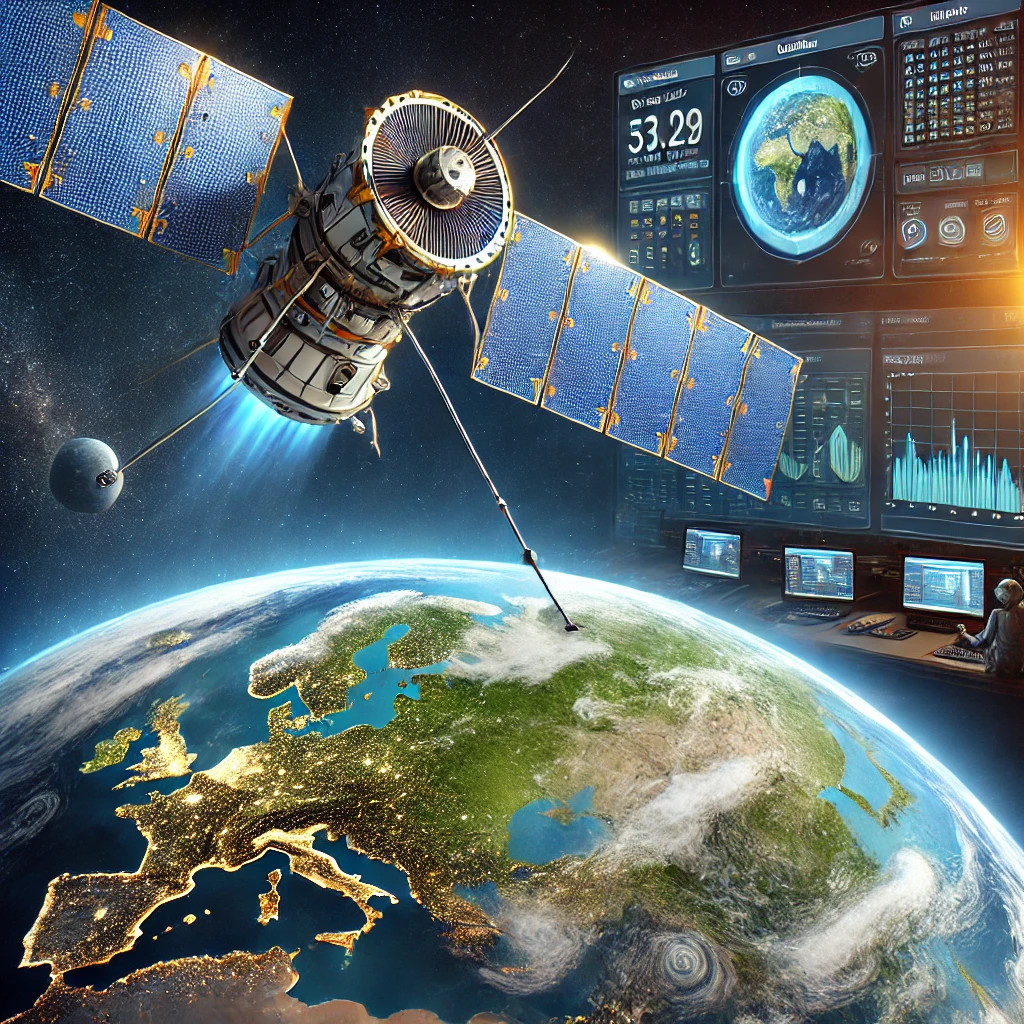
Looking down on Earth from space is like witnessing a miracle—a vibrant, swirling orb of blue, green, and white suspended against the vast backdrop of darkness. This perspective is not merely poetic; it provides invaluable data about our planet’s climate and environmental conditions. Satellites orbiting Earth monitor everything from temperature fluctuations and atmospheric composition to ocean currents and deforestation. These observations form the backbone of modern climate science, enabling researchers to study long-term trends, natural cycles, and the impacts of human activity on our global ecosystem.
As we continue our journey among the stars, it is crucial to recognize that space-based assets are integral to the preservation of our home planet. The role of space in climate change studies is both a testament to human ingenuity and a vital tool for ensuring a sustainable future.
The Evolution of Climate Observation from Space
The story of using space to study Earth’s climate began in the mid-20th century when the first weather satellites were launched. In 1960, the TIROS-1 (Television Infrared Observation Satellite) became the first weather satellite, providing routine images of Earth’s cloud patterns for weather forecasting. Since then, technology has advanced exponentially. Today’s satellites are equipped with sophisticated instruments that measure a wide range of variables—surface temperatures, greenhouse gas concentrations, ice cover, sea levels, and much more.
Advancements in remote sensing technologies have enabled continuous, global monitoring of Earth’s environment. Space agencies around the world, including NASA, ESA, and others, maintain fleets of satellites dedicated to Earth observation. These platforms not only complement data gathered by ground-based sensors but also provide a comprehensive, uniform view of our planet that is impossible to achieve from the surface alone.
Key Satellite Missions and Instruments
Several landmark missions have been instrumental in our understanding of climate dynamics:
MODIS (Moderate Resolution Imaging Spectroradiometer)
Aboard NASA’s Terra and Aqua satellites, MODIS instruments continuously capture detailed images of Earth in multiple wavelengths. These images are crucial for monitoring changes in vegetation, snow cover, sea surface temperature, and more. The consistent data provided by MODIS have helped scientists develop accurate models of global climate patterns.
GRACE (Gravity Recovery and Climate Experiment)
The GRACE satellites, launched in 2002 in collaboration between NASA and the German Aerospace Center, measure changes in Earth’s gravity field over time. These changes can be used to determine variations in water storage on land, including groundwater depletion, ice mass loss from glaciers, and shifts in ocean currents. GRACE data have been vital in understanding how climate change impacts the hydrological cycle and sea level rise.
Sentinel Missions
Part of the European Copernicus Programme, the Sentinel satellites focus on land, ocean, and atmospheric monitoring. With a suite of advanced instruments, they provide real-time data on environmental parameters, enabling rapid responses to natural disasters and contributing to long-term climate research. Their high-resolution imaging capabilities have greatly improved our understanding of deforestation, urbanization, and other human-induced environmental changes.
Landsat
Now entering its eighth generation, the Landsat program has been mapping Earth’s surface since 1972. With a continuous record spanning nearly five decades, Landsat data provide an unparalleled resource for studying land use, agricultural practices, deforestation, and natural disasters. This long-term data record is essential for detecting trends and informing sustainable land management practices.
How Space-Based Observations Impact Climate Change Studies
Monitoring Global Temperature Trends
Satellites measure both land and sea surface temperatures with incredible precision. These measurements help track global warming patterns, seasonal variations, and localized heat islands. Over time, the data reveal trends that are critical for understanding the pace of climate change and forecasting its future impacts.
Tracking Greenhouse Gas Emissions
Another significant contribution of space-based observation is the monitoring of greenhouse gases. Satellites equipped with spectrometers can detect levels of carbon dioxide, methane, and other gases in the atmosphere. This information is invaluable for assessing the sources and sinks of emissions, evaluating the effectiveness of environmental policies, and understanding how natural processes interact with anthropogenic influences.
Assessing Ice Melt and Sea Level Rise
Polar ice caps and glaciers are among Earth’s most sensitive indicators of climate change. Satellites like ICESat and Sentinel-3 monitor the thickness, extent, and movement of ice across the poles. These observations are essential for tracking the rate of ice melt and predicting future sea level rise. As rising seas threaten coastal communities worldwide, the data provided by these satellites are crucial for developing adaptation and mitigation strategies.
Observing Ecosystem Changes
Vegetation and land cover play a central role in Earth’s climate system. Satellites monitor changes in forest cover, desertification, and urban expansion. By analyzing these changes, scientists can assess how ecosystems respond to climate change and human activity. This information not only guides conservation efforts but also enhances our understanding of how natural systems contribute to global carbon cycles.
Supporting Climate Modeling and Forecasting
The sheer volume and quality of satellite data feed into sophisticated climate models that simulate Earth’s complex systems. These models help predict future climate scenarios, assess the impacts of various policy decisions, and guide international agreements on climate action. With every new satellite launch and improved sensor technology, our models become more accurate, enabling us to better understand and mitigate the effects of climate change.
Challenges in Space-Based Climate Observation
While satellites provide a wealth of data, they are not without their challenges:
Data Overload and Analysis Complexity
The vast amount of data collected every day by space-based instruments can be overwhelming. Processing, storing, and analyzing this data requires advanced algorithms and powerful computing resources. Scientists must continuously refine their methods to extract meaningful trends and predictions from this ocean of information.
Calibration and Accuracy
Ensuring the accuracy of satellite measurements is a constant challenge. Calibration of instruments must be maintained over long durations to account for changes in sensor performance due to harsh space environments. Even minor discrepancies can have significant impacts on climate models, so rigorous cross-checks with ground-based observations and inter-satellite comparisons are essential.
Orbital Decay and Satellite Lifespan
Satellites in low Earth orbit experience gradual orbital decay due to atmospheric drag, which can affect the quality and consistency of long-term data sets. Replacing aging satellites and ensuring continuity of observations is both a logistical and financial challenge. International collaboration and planning are key to maintaining an uninterrupted record of Earth’s climate.
Future Directions and Innovations
As we look ahead, several exciting developments promise to enhance our capability to study Earth’s climate from space:
Next-Generation Satellites and Sensors
New satellites, equipped with more advanced sensors, will provide higher resolution and more accurate measurements. Missions like the upcoming NASA Surface Biology and Geology (SBG) mission and ESA’s Biomass mission will offer improved insights into how vegetation and soil interact with the climate, helping us understand carbon dynamics on a global scale.
Integration with Artificial Intelligence
The integration of artificial intelligence and machine learning in data processing is revolutionizing how we analyze satellite data. These technologies can rapidly sift through massive datasets, identify subtle patterns, and even predict climatic events with unprecedented precision. AI-driven analysis not only enhances our understanding of current climate trends but also improves the accuracy of future projections.
Global Collaborative Networks
International cooperation is at the heart of space-based climate observation. As more countries launch their own Earth observation satellites, the opportunities for data sharing and collaborative research increase exponentially. By pooling resources and expertise, the global community can build more comprehensive and robust climate models that benefit everyone.
Final Thoughts
Today’s expedition into the role of space in climate change studies has illuminated the critical importance of satellites and other space-based instruments in understanding our ever-changing planet. These orbital sentinels provide us with a unique, global perspective on everything from temperature trends and greenhouse gas concentrations to ice melt and ecosystem changes. The data they capture not only advances scientific knowledge but also informs policies that are essential for combating climate change and preserving our environment.
As we continue to refine our technologies and expand our understanding of Earth’s climate systems, the role of space in environmental monitoring becomes more vital than ever. It is our window into the dynamics of the planet, and a reminder that in our quest to explore the cosmos, we must also safeguard the only home we’ve ever known.
Stay tuned, fellow explorers—tomorrow, we will transition to another captivating subject: Quantum Mechanics and Space. We’ll explore how the strange, counterintuitive principles of quantum physics intersect with our understanding of the cosmos, opening new realms of possibility for space exploration and technology.
Thank you for joining me on today’s journey into the intersection of space and climate studies. Until next time, keep your eyes on Earth and your gaze fixed on the stars, for every discovery brings us one step closer to a better understanding of our universe.
Captain Nova
Odyssey Explorer
Leave a Reply